It was awesome to wake this morning with the Alps out of our bedroom window. It was not quite as awesome to be woken by the Sunday morning church bells at 7am on one of the few days we could have had a sleep-in.
After a slower start to morning we were off on our 'Mountain Day'. The first stop on the trip was Zugspitze (meaning: Avalanche path peak) which is the highest mountain in Germany. We had booked tickets on the Zugspitzebahn, the cable car to the top of the mountain. The 15th of July had been crystal clear skies and we were excited about getting to see a clear view of four countries (Germany, Austria, Lichtenstein and Switzerland) from the top of the 2,962m peak.
Unfortunately, we woke to this:
It was hard to believe that the weather could have changed that much, but we'd booked our tickets so off we went to the Tyrolean Zugspitzebahn.
The Zugspitzebahn was first built in 1926 and has been upgraded several times since. It travels from the town of Ehrwald at 1,225m above sea level to the summit of Zugspitze at 2,950m. The cable car travels at about 36 km/h and takes just under 10m to travel to the top.
Our view on the way up wasn't the best, but there was hope that the cloud might clear later
 |
| Base Station |
 |
| Live webcam of the view from the top before we went up |
 |
| Starting up the mountain |
 |
| There's a bit of sun there! |
 |
| Just white outside all of the windows |
When we reached the top we decided to start by checking out the museum before heading out to the viewing platforms, in the hope that the cloud would clear a little.
 |
| Model of Zugspitze |
 |
| One of the old carriages |
 |
| Tomas in the old carriage |
 |
| One of the strangest World Records I've heard of.. |
After the museum, we headed out to the lower of the two summit platforms to see how much we could see. Initially everything was just clouds, but eventually it started clearing.
We took some pictures and then checked out the snow crystal display, showing the unique shapes of snowflakes that have been able to be detected with the new technology. Previously melting of the flakes prevented the full shape to be analyzed, however the new system is a glass tube that allows the flakes to fall through. A high speed camera captured the creation of the flakes and clearly showed their shape.
We then stopped for a coffee in the panoramic restaurant and then went outside for a final check at the summit. Fortunately more cloud had cleared so we had a bit more of a view.
 |
| The summit marker |
 |
| Not much to see out of the binoculars |
 |
| Climbers |
We headed down around midday and the clouds cleared a little more making it a much more scenic view down
Our next stop involved some serious heights, so we dropped Cameron back at the apartment so he could do his University work, and Kris, Tomas and I headed to Ehrenberg.
We had seen the Ehrenberg Castle ruins on the mountain as we drove around the area and more obvious was the Highline179, a huge hanging bridge over the road:
 |
| Ehrenberg Ruins on the mountain to the left and the Highline179 between |
Ehrenberg was built in 1296 and was built to block the valley and to be used as a customs station between north and south trade routes.
The castle was besieged in 156 by the Schmalkaldic (a military alliance of Lutheran princes within the Holy Roman Empire during the mid-16th century) forces. The Austrian forces managed to retake the castle by stationing cannons on the nearby Falkenberg mountain. The Austrians then fortified Falkenberg to prevent this tactic from being used against them. The fort on Falkenberg was named Fort Claudia after Archduchess Claudia of Medici, who ruled Tyrol from 1632-1648.
In 1703 the Bavarian forces invaded the castle and Fort Claudia. The forces in Fort Claudia surrendered without a fight and the main castle was taken.
This time, the Tyroleans managed to recapture the castle using similar tactics, this time placing cannons on Schlosskopf and bombarding the castle. Once the castle was retaken, the Austrians fortified Schlosskopf.
 |
| The opposing lines of bombardment |
 |
| Map of the castle locations |
There were four main things to see, Ehrenberg ruin, Schlosskopf, Fort Claudia and Highline179. Two rail-lines run up the mountain, the first goes from the base (Ehrenberg Klause) to just below Ehrenberg Castle, this is called the Ehrenberg Liner. The second goes from there to Schlosskopf at the top of the mountain and is called the Top Liner. Each liner and the Highline 179 have separate costs, so we opted for the Highline and the Top Liner and walked up to the Ehrenberg Castle ourselves.
 |
| The Ehrenberg Liner |
 |
| Ehrenberg Klause |
 |
| The walk up to the castle was fairly steep and the humid 30 degrees didn't make it the most fun walk, even in the shade |
 |
| There was a flying fox (the Dragonfly) at the Ehrenberg Liner station that went back down to the car park |
 |
| Flying Fox line |
 |
| Signs on the way up gave information about Castle myths. There was also a kids quest book that was marked with the green signs |
 |
| The fortified gate to the walls |
 |
| The Gate |
 |
| Playground with the castle ruins in the background |
 |
| Tom was arrested for malicious loitering |
 |
| When he didn't atone he was moved to a more suitable cage |
 |
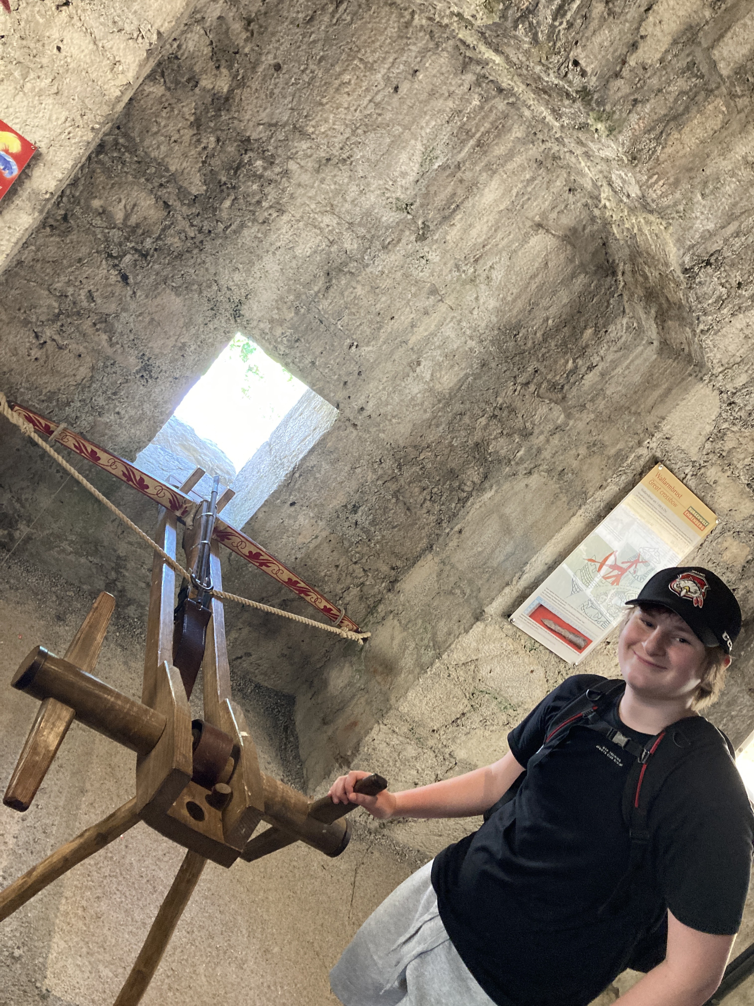
| He was much happier to be firing the mounted crossbow |
 |
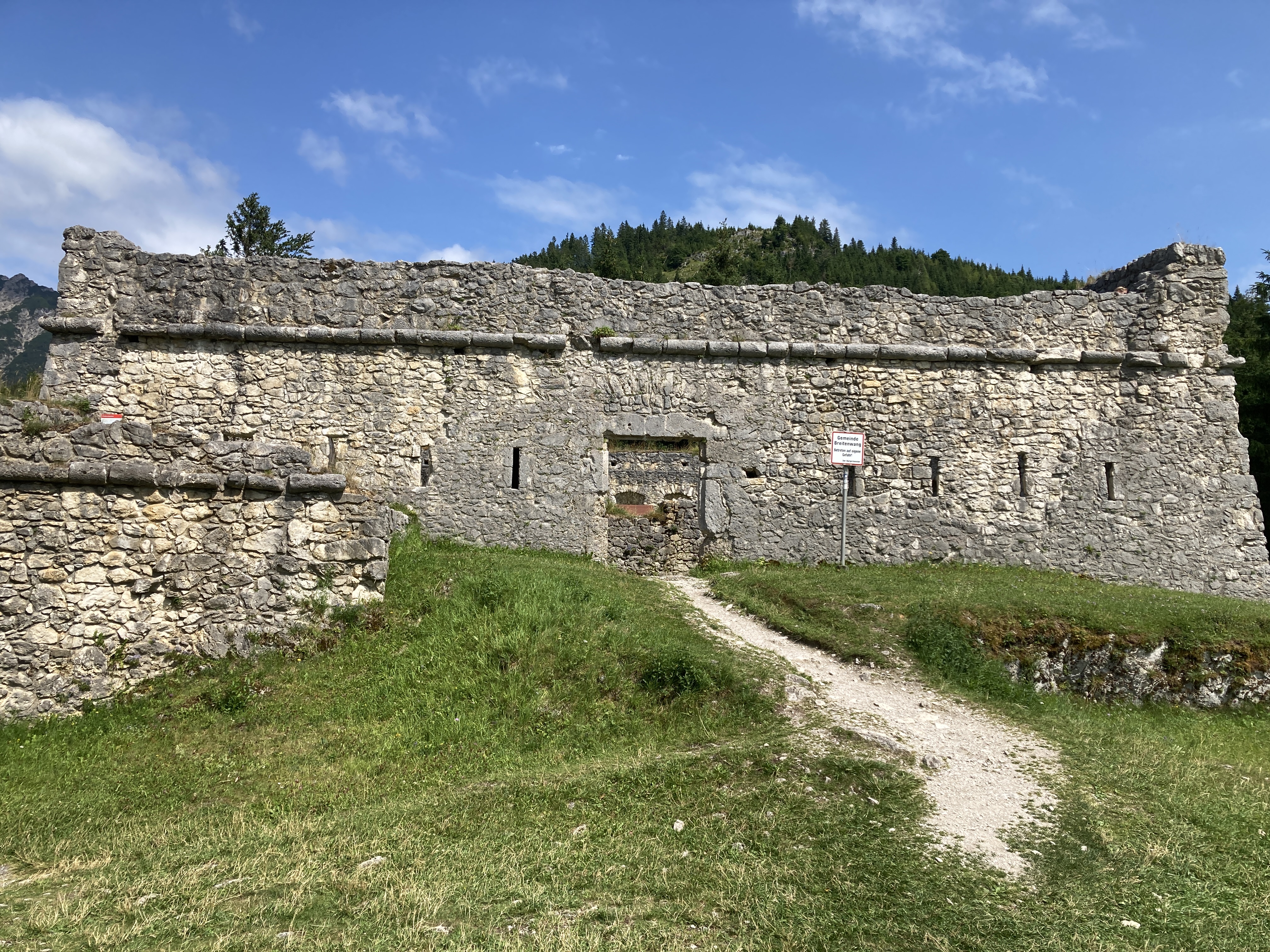
| Ehrenberg Castle |
 |
| Looking back at the gate and the Top Liner |
 |
| Panoramic of almost 360 from the castle lookout |
 |
| On the castle walls |
 |
| View from the castle, including the Highline179 |
 |
| View from the rear of the castle |
 |
| Tom didn't manage to pull the sword from the stone |
 |
| The walk up to the ruins was pretty steep |
 |
| Tom and the view from the castle |
 |
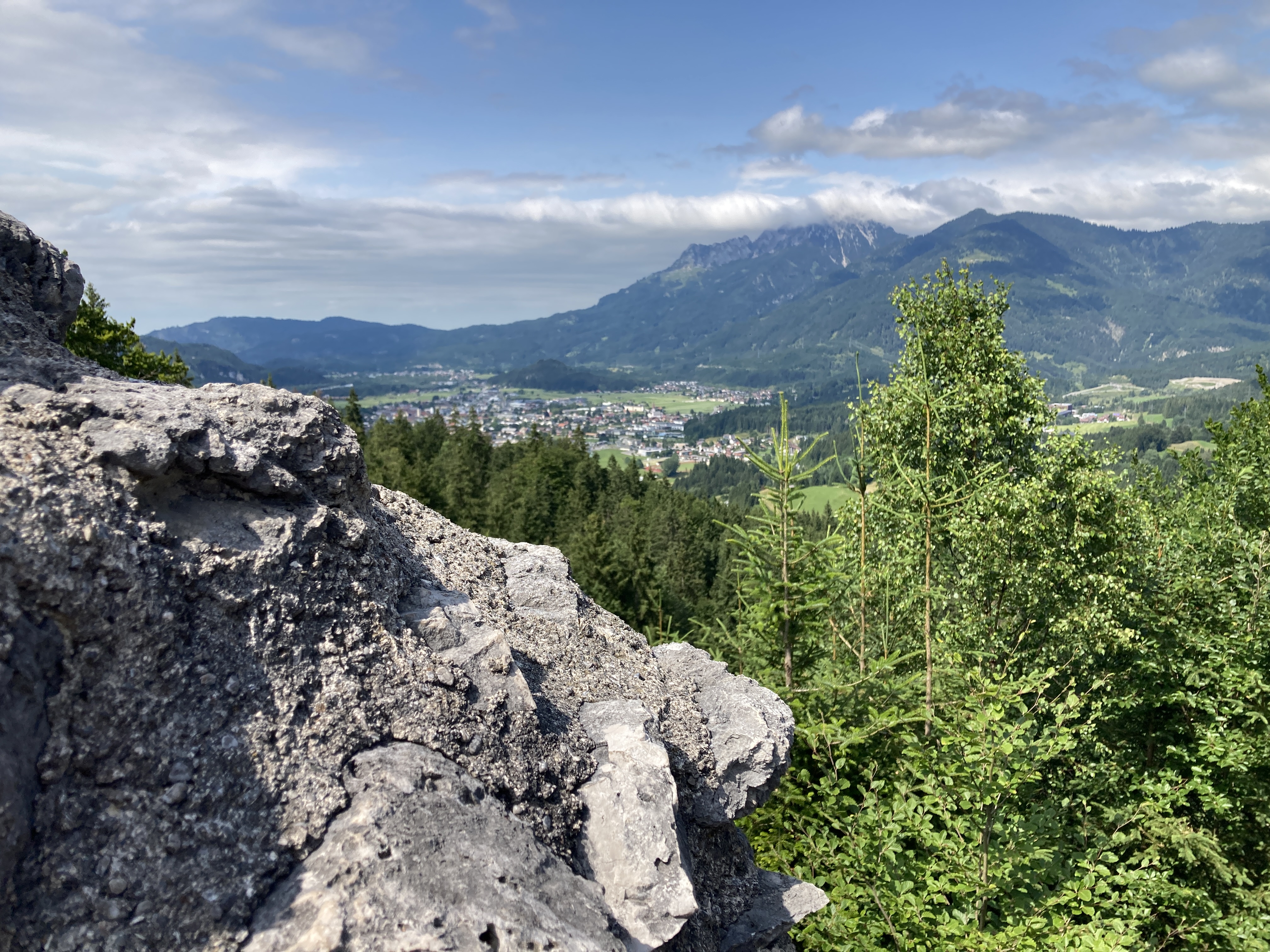
| View from the castle |
 |
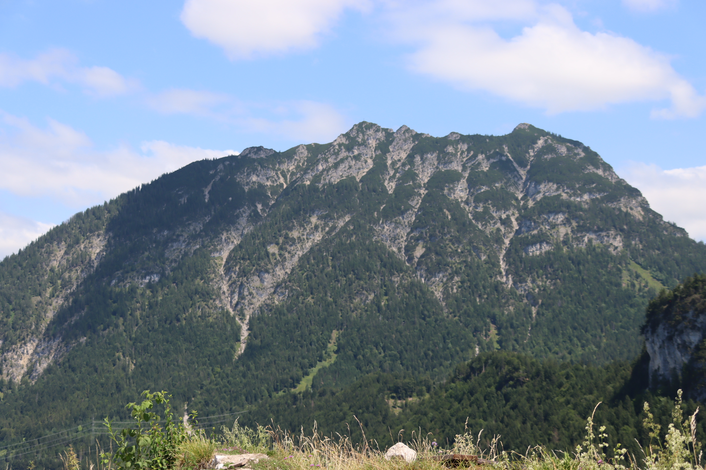
| View to Falkenberg where the castle was bombarded from |
 |
| View from the top lookout |
 |
| View to Schlosskopf, the other site the castle was bomnbarded from |
 |
| Leaving the castle via the 'secret tunnel' |
We then had to choose whether we headed up the Top Liner to Schlosskopf, or headed over the Highline179 to Fort Claudia. We were not sure if the Highline ticket allowed us to return (it did), so we decided to visit Schlosskopf first.
We took the trip up on the inclined rail, Top Liner to the castle ruins.
 |
| View going up the Top Liner |
 |
| Ehrenberg from above - you can see how easily it could have been bombarded from here |
 |
| View from the top |
 |
| Layout of the Fortification |
 |
| The dragon |
 |
| One of the lookouts |
 |
| The view from the lookout |
 |
| The view from the top lookout |
 |
| Ehrenberg castle and the Highline179 |
 |
| View of Fort Claudia |
We then headed back down the Topliner and then headed over the the Highline179. The Highline179 is a bridge that connects Ehrenberg with Fort Claudia allowing easy access to both ruins, but it is also an experience itself as it is 114m over the valley.
The bridge was created in 2014 and it is in the Guinness Book of Records as the "Longest Tibet-Style Footbridge"
The specs from the bridge's website (https://www.highline179.tirol/en/bridge) state that the bridge is 406m long, 1.2m wide and has a dead weight of 70 tonnes.
 |
| Some pretty solid anchors |
 |
| The view straight down |
Across the bridge we came across the ruins of Fort Claudia:
 |
| The gun slots were designed too narrow for the musketmen to use their weapons effectively |
 |
| The indent marking where the second floor had been |
 |
| The bastion |
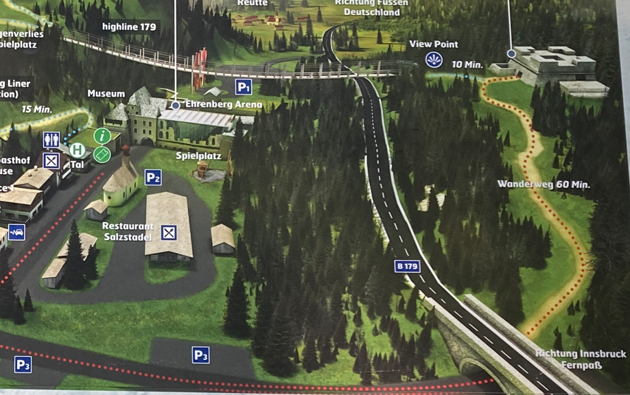
After finishing at Fort Claudia we were ready to head back to our apartment. Kristine wasn't super keen on crossing the bridge again, so we decided to take the Wanderweg, which was shown as a fairly easy walk. Since we were parked in carpark P3, we didn't need to do the full 60 minutes, so predicted just over 30min.
 |
| The red dotted line. We were in parked in P3 |
The path started well, a solid packed stone path which was clearly marked. It was still really warm (30 degrees and very humid) but the walk wasn't too bad. Then it became a bit more of a goat track:
and then the markings weren't quite so clear... We ended up walking down a 30 degree slope for about 15min before realising it didn't head where we thought it should and we had to turn around and head back.
When we finally saw the tunnel that was marked on the map, we were very happy, it had been a very warm 1.5hr walk:
Despite the heat, there was some time to get some pictures of the local butterflies:
We had thought our adventures were over when we finally emerged from the forest, but that wasn't quite the end of the story. We were about halfway home when we realised that we needed to pick up some supplies, bread and milk etc. Kristine thought she remembered a shop just past out apartment so we headed that way, and came to first realise that, nope, there was no shop, and secondly that there was a massive traffic jam that was still building. We ended up managing to squeeze a U-turn in. We considered just pulling into the apartment as we were all tired and sweaty, but we decided to drive back to the shops in the nearby town... which were all closed for Sunday afternoon. While we considered our options, the traffic continued to back up down our road and a red-cross helicopter flew over.
Since getting back home didn't seem likely, we drove on past Ehrenberg and found a petrol station with a supermarket attached. By the time we'd picked up our supplies, the worst of the traffic jam had cleared and we had a decent run home.


No comments:
Post a Comment