The plan today was to visit the Normandy Beaches and World War II sites. It was going to be a long day, but one we were all looking forward to.
Unfortunately the day started like the previous one, with Tomas dropping his phone as he was getting into the car, breaking the LCD screen (which later cost us 1000sek to fix).
Normandy was an interesting area to drive through - the narrow streets with the bricklined walls made the driving a little more exciting that it needed to be, especially coupled with crazy French drivers, but were great to look at. To top it all off, we had beautiful weather - about 18 degrees with sun.


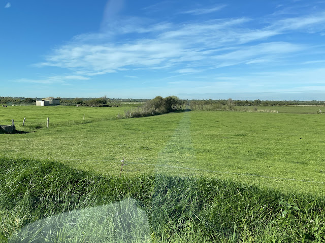
One of the things I remember reading was about the terrain in World War II - the French countryside was 'bocage' meaning farms or fields surrounded by hedgerows and woodland. This made the D-Day invasion difficult because it provided good cover for the German troops and wide swathes of no-man's land which were dangerous for the allies to cross.
Our first stop just west of the first of the beaches - Utah beach - The Fortification Allemande (Stützpunkt 12), one of the bunkers that made up the Atlantic Defence line:
Just a little further down the road was a Memorial and Monument to the landing of the French 2nd Armoured Division.
 |
| The badge of the 2nd Armoured Division |
The French 2nd Armoured Division was formed from several divisions that had left France after its surrender and fought in the allied North Africa campaign. Led by General Phillippe Leclerc, they landed at Utah beach on August 1st, two months after the D-Day landings and assisted with the break-out from Normandy and the liberation of Paris. The allies originally were planning to avoid attacking Paris to avoid it being destroyed by the Germans, and instead were focussing on defeating the German forces around it. When the French resistance led an uprising in the city, Charles de Gaulle convinced the allies to send the 2nd Armoured Division along with the US 4th Infantry Division to liberate Paris.
The site housed some vehicles and memorial signs as well as one of the ten signal monuments - made to look like the a ship approaching the shore.
 |
| M8 Greyhound Armoured Car |
 |
| M3 Half Track |
 |
| The site |
 |
| Cross of Lorraine - the symbol of the 2nd Armoury Regiment |
 |
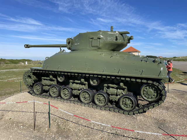
| M4A2 Sherman tank |
 |
| Liberty Marker - Marking the Liberty Trail |
The Liberty Markers were placed every 1km along a 1,146km route from Sainte-Mère-Église to Belgium marking the route taken by the allied liberation forces. Each one shows the torch of liberty coming from the sea and heading eastward. There are 48 stars around the top, representing the 48 states of the USA (as they were in 1944).
Next stop was the Utah Beach memorial.
Utah was the westernmost of the Normandy Landings and was the focus of the American forces. The goal of the attack was to capture the Cotentin Peninsula and the port of Cherbourg. Just after midnight on the 6th June 1944 the 82nd Airborne and 101st Airborne. The plan was for them to capture Sainte-Mère-Église to assist the Utah landing, but the paratroopers missed their drop site and many only made it to their location after the landing forces had already secured the area. 21,000 troops from the 4th Infantry Division landed and suffered 197 casualties in taking the beach. They succeeded in capturing the beachhead, but failed to take Cherbourg until the 26th June, and the Germans had already managed to sabotage the port. This was because they landed too far south. The airborne forces numbered 14,000 men and suffered 2,500 casualties.
The Utah Beach landing zones were split into Tare Green and Uncle Red:
The Utah Beach Memorial is located just before the shoreline starts to curve to the south at the end of the Utah beach area.
The memorial site housed several memorials and exhibits, including the Landing Museum, Higgins Boat Monument, US Navy Monument, 90th Infantry Division Monument and Le Roosevelt.
 |
| First view of Utah Beach Memorial Site |
 |
| Tank Traps |
 |
| Tank and Museum |
To the far right of the site was "L'Arbre de la Liberté" - The Tree of Liberty. Created in 2014, this tree sculpture had several leaves in different languages celebrating peace and freedom:
Next to the was the museum, housing one of the six remaining B26 bombers (Martin B-26 Marauder). Hundreds of these planes attacked the peninsula on D-Day, about 290 targeting Utah Beach - there is a good article about the bomber here.
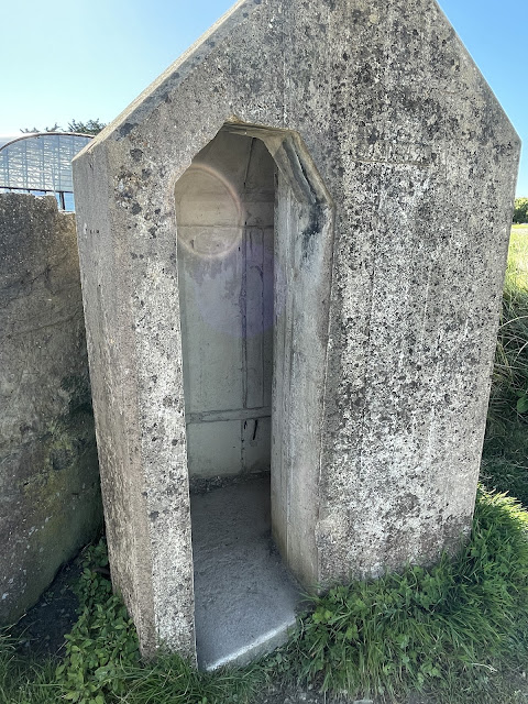
In front of the museum was a tank and sentry room:
To the left side of the memorial was Le Roosevelt, now a gift shop and café, but once a German bunker disguised as a house. The Germans used the site as a communications bunker until it was captured by the allies, who also used it for communications.
There is a World War II photo showing soldiers outside the wall of the bunker:
In front of Le Roosevelt is a Higgins Boat memorial. The Higgins Boat (or Landing Craft, Vehicle, Personnel (LCVP)) was the landing craft that was used to land the forces and vehicles on D-Day. They were based on a design by Andrew Jackson Higgins in New Orleans originally for oil and gas exploration.
The main benefit of these boats was that the troops and vehicles could exit from a landing ramp as opposed to other designs which required the troops to jump over the side and be exposed to enemy fire. Before the use of these boats, the navy needed ports to land troops in force, making any marine assault extremely difficult and costly. By using landing boats, the troops could land almost anywhere on the coastline and forced the enemy to cover more area, rather than just focusing on defending ports.
The boats did have their weaknesses - with a maximum speed of 12 knots, and a flat hull, the boats would rock in the waves and could lead to seasickness. They were also generally constructed of plywood to keep costs and weight down, but this also made them vulnerable to enemy fire.
Utah Beach houses a replica of one of the Higgins Boats:
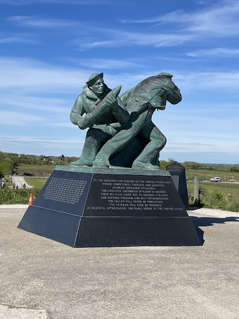
Next to this is The Lone Sailor - a monument to the US Navy men and women:
We then walked down to Utah beach and the US Navy Monument:
 |
| looking down at Utah beach where horse and chariot races were taking place |
From Utah Beach, our next stop was the Maisy Battery. This was an artillery battery that was created as part of the Atlantic Wall defence and was constructed in secret to keep it from the allies. The battery and associated bunkers were built by Soviet, Czech and Polish labour to avoid any locals providing information to the allies.
Prior to D-Day, the Germans had made it obvious that they had a major battery located at Pointe du Hoc, hoping to draw attention away from the Maisy Battery, however the battery was marked as a target for the Rangers on D-Day.
Prior to the invasion, the battery at Pointe du Hoc was reduced to a few dummy guns and a token force, with the intent being that it would draw enemy fire and Maisy Battery would be free from attack. The Maisy Battery consisted of three separate batteries - Les Perruques, La Martiniere and Foucher Farm. The Foucher Farm battery was destroyed by naval bombardment, but the other two remained until the allies captured them 3 days after landing.
The battery was lost until 2004 and when it was located partially buried and covered with undergrowth, using old maps of the area.
We didn't enter the site due to time and admission cost, but we did get some pictures from outside:
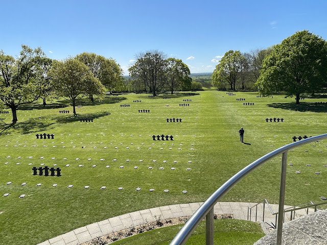
Our next stop was the German cemetery at Le Cambe, where 21,245 German soldiers were buried. While the Germans were the enemy during the war, a majority of these soldiers were in their early twenties and also victims of the war machine. The German cemetery was markedly different from the nearby American cemetery.
There is a sign at the front of the cemetery that reads:
The German Cemetery at La Cambe: In the Same Soil of France
Until 1947, this was an American cemetery. The remains were exhumed and shipped to the United States. It has been German since 1948, and contains over 21,000 graves. With its melancholy rigour, it is a graveyard for soldiers not all of whom had chosen either the cause or the fight. They too have found rest in our soil of France.
As stated, La Cambe was originally a mass burial site with Americans and Germans buried in adjacent fields. After the war, the American soldiers were exhumed and either moved to the American Normandy Cemetery or returned home to the USA and German casualties from around the Normandy area were exhumed and brought to La Cambe for burial.
The site consists of rows of small black plaques and black crosses and in the center is a hill (or tumulus) with two statues and cross of black basalt.
While the American cemetery is fully funded, the German cemetery is run by volunteers and donations.
After the German cemetery, our next stop was Pointe du Hoc. I mentioned this site briefly in the Utah Beach section - it was an artillery battery that was set up on a cliff overlooking Omaha Beach. When the allied forces arrived, they needed to scale the steep cliffs to the gun emplacements at the top, while under fire from the German forces on either side of the cliffs. Using rope ladders and grapples, the soldiers gained access to the top of the cliffs only to find that most of the guns were removed and replaced with decoys. The guns were later found in a nearby field and were destroyed.'
The Rangers who assaulted the cliffs lost 15 men in the ascent (this number was kept low due to naval support bombardment), but after having to defend against multiple counter-attacks by German forces, the overall unit of around 225 men was reduced to 90 that were fit to fight. They were relieved on the 8th of June (2 days later) by other landing troops.
The Pointe du Hoc site was set up with a tourist centre and a walk around the gun installation sites to the top of the cliffs.
The ground of the Pointe was severely pockmarked with craters from the naval and air bombardment, and the damage was obvious as we walked through the area:
There were still the remains of bunkers and gun installations around the site, and a memorial at the end on top of the cliffs:
The memorial was built on an old gun emplacement and gave an impressive view out over the cliffs. This gave a real impression of the incredible climb that the Rangers had to undertake in order to scale the cliffs.
On the way back to the car we passed a display of one of the guns that would have been part of the Pointe du Hoc defenses:
Our next stop was Omaha Beach, the most famous of all of the beaches and the site of the most intense D-Day fighting.
Omaha Beach was the just east of Utah is 8km long. The landing was undertaken by the American forces, with the 1st Infantry Division assaulting the eastern segment of the beach and the 29th Infantry Division and nine companies of Rangers assaulting the western. The 1st Infantry were experience soldiers, having fought in Algeria as part of Operation Torch (the allied invasion of North Africa), but the 29th had yet to see action in the war.
The invasion was overall a success, but after being plagued by problems it ended up being the most costly and prolonged of the attacks.
Issues with navigation caused most of the landing craft to miss their landing areas and the German defences were much stronger than expected - 12,000 troops of the 352nd Infantry Division, 6800 of them experienced fighters. The overcast conditions meant that the allied bombers overshot their targets and few of their bombs landed on the German defences. The naval bombardment was more successful, but limited to only one battleship, two cruisers and six destroyers.
Some of the initial landing craft were sunk in the rough sea conditions and many of the landing troops were badly seasick. The ineffective bombing and higher than expected enemy defenders meant that the landing ships came under heavy fire early on. The landing ships also ran aground on sandbars, which forced the soldiers to wade ashore, a distance of 200m, with their full kit under heavy fire. The loss of officers meant that many of the survivors were disorganized and confused by the time they made it to the dubious safety of the bluffs.
We parked at the western edge of the beach, at the sector known as Dog White, the second westmost area of the beach landing.
From west to east, the sectors were: Dog Green, Dog White, Dog Red, Easy Green, Easy Red and Fox Green.
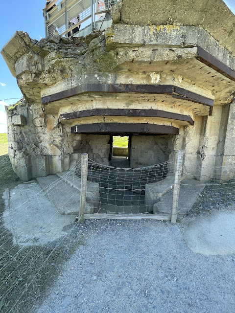
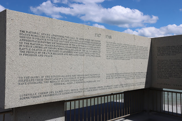
At Dog White was a memorial to the National Guard, a bunker (Bunker Vault d'Alexis) and the remains of Widerstandsnest 72. As part of the German Atlantic Defences, the Widerstandsnest (Resistance Bunkers) were established along the coastline, housing guns and troops. There were a large number along the beachfront and on the bluffs beyond.
 |
| National Guard Association Monument |
 |
| Memorial to the Soldiers of the 29th Division |
 |
| The bluffs overlooking the beach, including Wilderstandsnests |
 |
| Wilderstandsnest 72 |
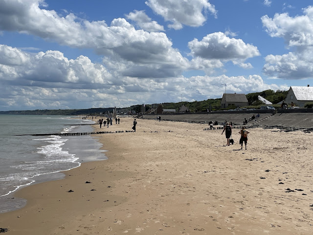
From Dog White we walked down the beach to the main Omaha Beach monument at Dog Red about 2km down the beach:
Dog White was housed the Signal Monument and a sculpture "Les Braves":



















No comments:
Post a Comment